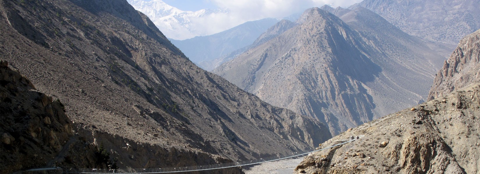
Trip Details

  • Destination: Nepal
  • Trip Difficulty: Moderate
  • Trip Style: Trekking
  • Transport: Private Vehicle / Bus / Aeroplane
  • Food: Breakfast + Lunch + Dinner
  • Accommodation: Lodge to lodge
  • Group Size: 1 - 16
  • Max Elevation: 5416 m

About Trip

In addition to Everest, the Annapurna region belongs to the most popular trekking region of Nepal, because of the Annapurna I (8’091 m) which is the tenth highest mountain in the world. It offers a fantastic view of Manaslu and Himchuli to the east and further north of the Himalayas to the dry Tibetan Plateau, a breathtaking scenery.

The name of Annapurna is composed of anna (food) and purna (filled); Annapurna is the food-giving goddess or the goddess of wealth.

The highest point of the hike is the Thorung La pass with its 5'416 meters above sea level. Due to the height and difficulty of the pass, usually crosses are counter-clockwise made. If we climb up from Manang to Muktinath from the west, the trail continues through the barren Kali Gandaki Valley - the world's deepest canyon flows through between the giant Annapurna and Dhaulagiri mountains. Other highlights are the hot springs of Tatopani, the magnificent view of point Poon Hill 3’210 m, and rich cultural life. There are many different charming villages of different ethnic groups. The trail goes through the Muktinath Temple, which is a holy temple for Hindu and Buddhist people many Nepalese and Indian people visit Muktinath for praying, they believe if they take bath and pray at Muktinath god bless them to fulfill their Wish.


Highlights

  • Panoramic View of high Mountains (Annapurna I, Manaslu, Himchuli, Dhaulagiri, Annapurna South, Fishtail and more)
  • Hot spring at Tatopani 
  • Charming Villages of a different ethnic group
  • The holy Temple Muktinath
  • The World's deepest canyon flows between the giant Annapurna and Dhaulagiri mountains
  • The magnificent viewpoint of Poon Hill

Outline Itinerary

  • Day 1Arrival In Kathmandu
  • Day 2Drive from Kathmandu to Besisahar 760 m
  • Day 3Besishahar to Bahundanda 1310 m
  • Day 4Bahundanda to Chamje 1430 m
  • Day 5Chamje to Bagar Chhap 2160 m
  • Day 6Bagar Chhap to Chame 2670 m
  • Day 7Chame to Pisang 3300 m
  • Day 8-9Pisang to Manang 3540 m
  • Day 10Manang to Ledar 4250 m
  • Day 11Ledar to Phedi or High Camp 4600 m
  • Day 12Phedi or High Camp to Muktinath 3760 m
  • Day 13Muktinath to Jomsom 2720 m
  • Day 14Flight from Jomsom to Pokhara
  • Day 15Drive from Pokhara to Kathmandu or enjoy Pokhara
  • Day 16Departure
Check Detail Itinerary

What's Included

  • National Park permit for the Trekking
  • TIMS card (Trekkers Information Management System)
  • Accommodation during the trek
  • 3 meals (Breakfast, Lunch, Dinner, it comes with 1 cup of thea) during the trek
  • English speaking, experienced and government registered Trekking guide
  • Number of porter according to the group size (1 Porter for 2 trekkers)
  • First aid kit and insurance for the team
  • Transport to the trekking spot
  • Airport pick up and drop off
  • Tax and Service Charge
  • Any kind of drinks/beverage
  • International flights
  • Personal expenses
  • Personal Insurance and medication
  • Nepal entry visa
  • WiFi
  • Tips for guide and porter

What Our Clients Say